


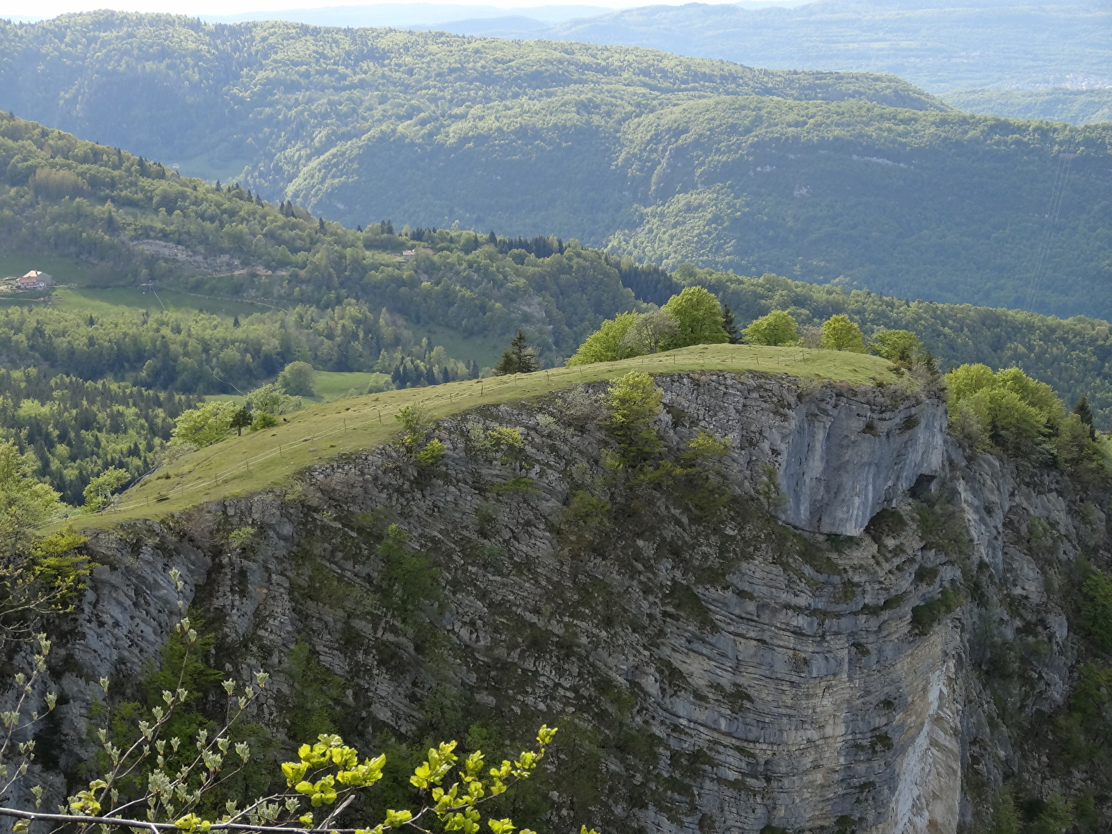
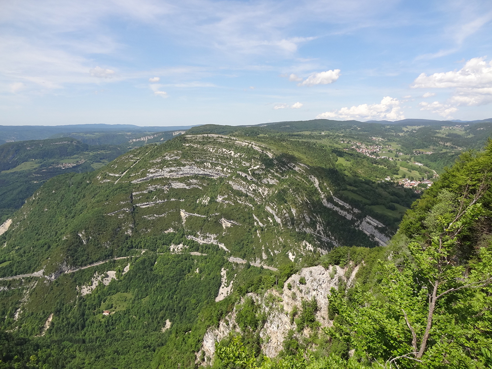
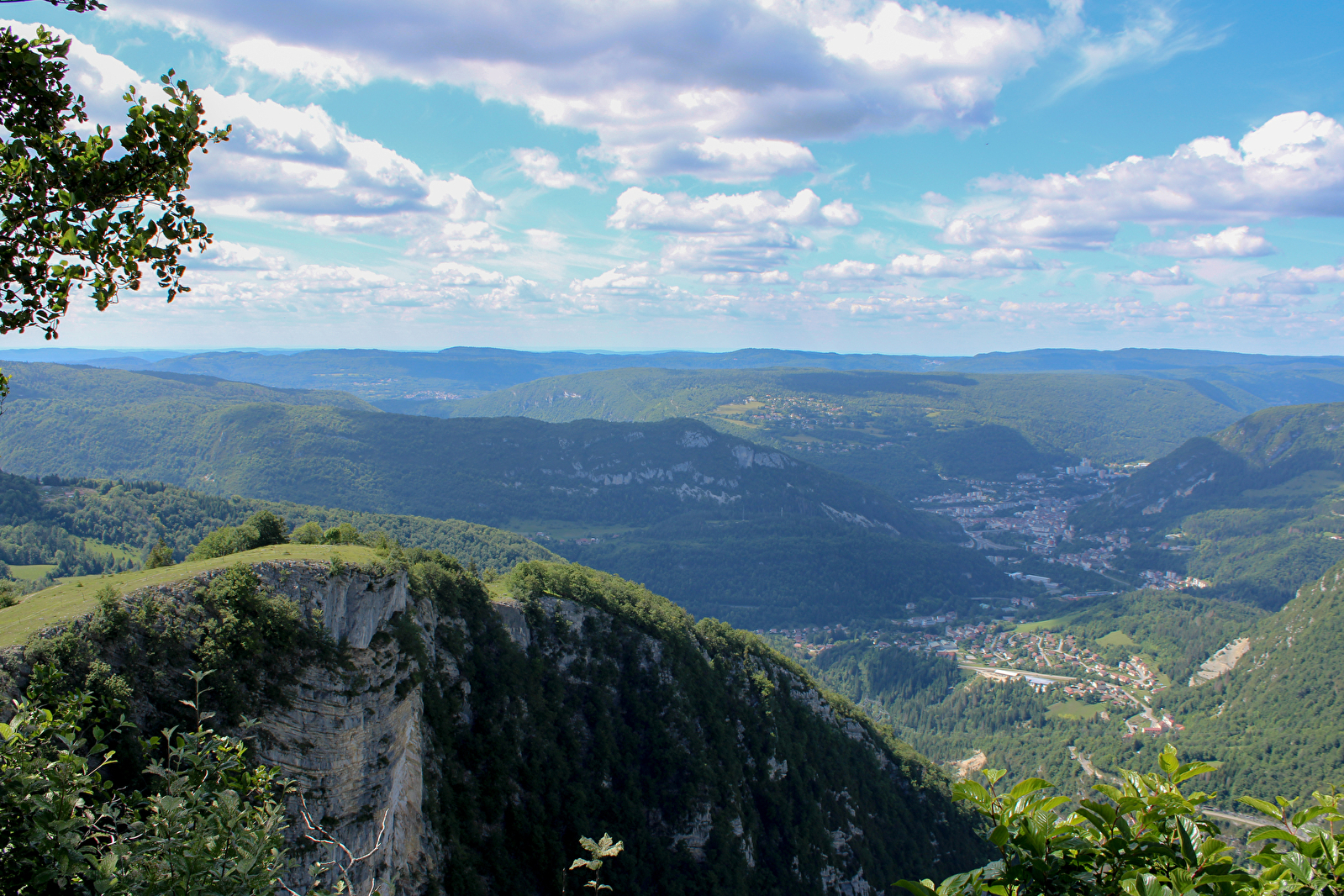
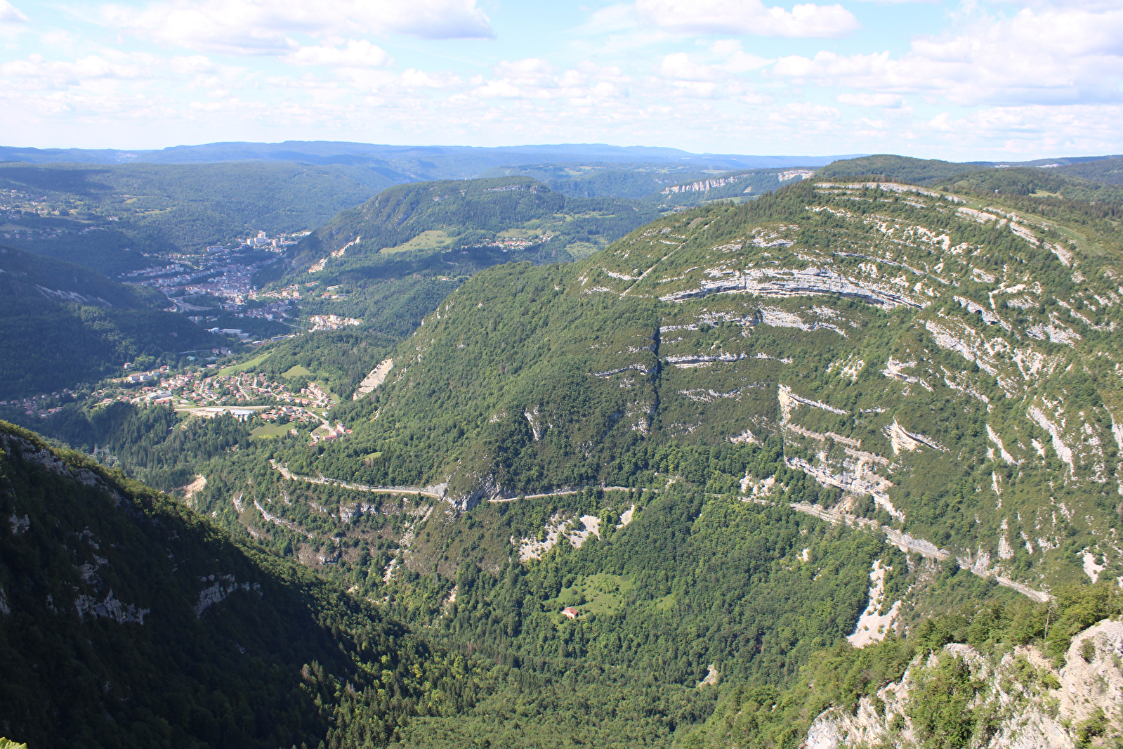
Belvédère de la Roche Blanche
Discover the Roche Blanche lookout
Return path
Septmoncel Les Molunes
Time : 0h10
Distance: 0.5km
Difference in altitude: +10m
Yellow markings
Be impressed by this 360° panorama and the aerial view of the town of Saint-Claude, the Cluse du Flumen and its waterfalls, and the surrounding rock folds. An ideal spot for a picnic with a breathtaking view of the Haut-Jurassien landscape.
Access: Leave Saint-Claude heading towards Geneva. Pass through the hamlets of Essard and Montbrillant. Continue for 5 km through the Septmoncel hairpin bends. At the crossroads at L'Evalide, turn right towards Les Moussières. At "la Cernaise", turn right to reach the small car park under the belvedere.
GPS coordinates latitude :
N 46.350043 / longitude E 5.889464
Sporty option: return path (from the power station). 3h30 - 4 km - altitude difference +700m
ACCESS: Leave Saint-Claude heading towards Geneva (D436). Follow the sign for Gorges du Flumen. At a place called "Rochefort", take a small road
which descends to the right towards the Martinet campsite. Cross the first bridge, then the second. At the hamlet of Le Martinet, the Flumen trail begins on the left. You can continue by car along this narrow road as far as the Flumen power station. Take the path uphill towards the viewpoint.