


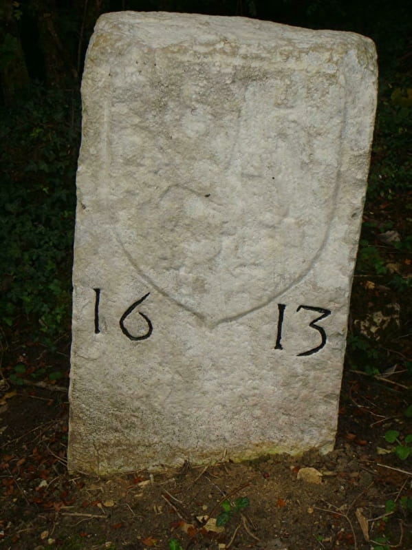
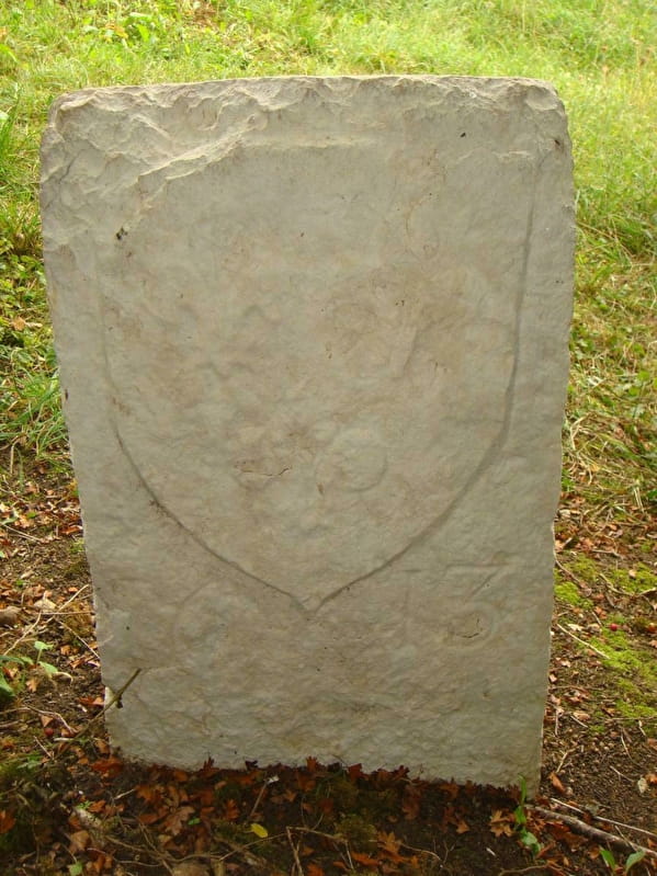
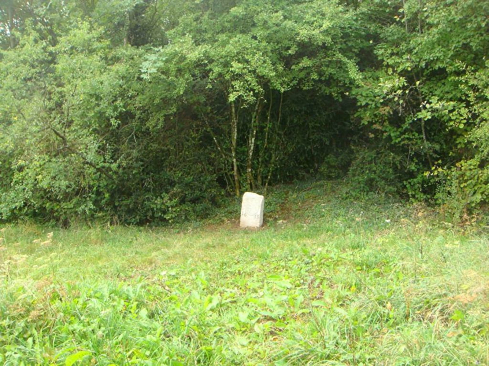
Borne frontière de 1613 - Verjon
Pedestrian access GR59 :
- From the Plain Champ pass (car park)
- From Dingier
Place in a meadow not far from the path and still marks the Ain-Jura border.
This boundary marker is part of a series of boundary markers erected in 1613, marking the new border between the kingdom of France (after the capture of the Revermont, Bresse and Bugey from the States of Savoy by the King of France) and the kingdom of the Holy Roman Empire (Franche-Comté). This followed the Treaty of Lyon, of 1601, as well as that of Auxonne, of 1612.
A state border was born!
Several viewpoints and panoramic views of the typical Revermont parcel of land. Remains of Capettes (dry-stone huts). Access to Mont-Myon, the Roissiat quarry and Dingier.
Boundary with Franche-Comté
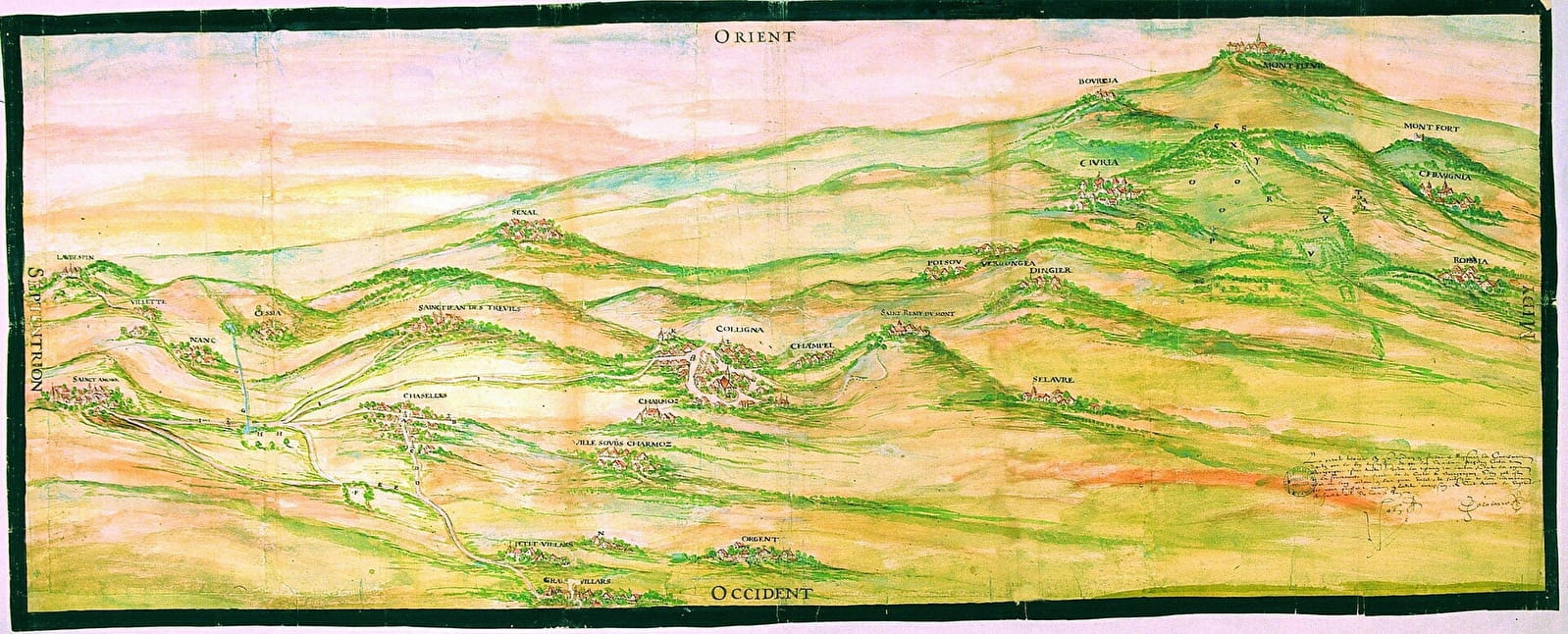
(see the Tiberiade in illustration: relief map)
To be discovered: the delimitation of Burgundy and Franche-Comté by a tiberiade of the disputed places towards Coligny (Civria, Chazelles, Saint-Jeand'Etreux, etc.), decided at Saint-Amour, on 21 July 1611.
In addition to the fate of the lands in abeyance on the northern borders of the duchy and county of Burgundy in the 15th century, the treaty of Câteau-Cambrésis between France and Spain had provided in 1559 that other disputes over the limits between the two "sovereignties" further south, particularly towards Bresse, would also be settled amicably. However, it was not until the end of the internal and external wars supported by France until the time of Henry IV that negotiations on these border disputes began.
On 6 June 1611, conferences finally began in Auxonne between a deputation from the Dijon Parliament, acting on behalf of the King of France, and an equal deputation from the Dole Parliament, acting on behalf of the Archdukes Albert and Isabella Claire Eugenie, who were then ruling Franche-Comté from Brussels. Disputes over the entire border area, from Bassigny to Bresse, were examined on the spot and on the spot until 15 February 1612, when a treaty was signed between the deputies, ratified on 2 March by the Archdukes and on 3 April by Louis XIII. Final adjustments were then made in response to local complaints, until 20 April 1613, when the deputations signed the final minutes of their work in Auxonne. The debates on the disputed locations around Coligny took place in July 1611 and February 1612.
Legend Tiberias (old map)
A is the Magnin Cross; B is the Gille Cross; C is the Souillart Cross; D is the cart track leading to Belfort; E is the road leading to the Sauges Prey; F is the Sauges Prey; G is the Saubagnaut reach; H is the Ripes area; I the main road leading from Sainct-Amour to Coligny; K the castle of Coligny-le-Viel; L the castle of Coligny-le-Neuf, said to be in Menton, and the town around it; M the church and houses in the commune of Colligny; N the house of Guillaume Dojac; O the place called Planchan; P the cross called by the deputies of the king "the Brotet Cross"; Q the place where the deputies of the king said that it is the Jean-François Cross and the deputies of the archdukes the said Brotet Cross; R the wall and bush Ragois; S the mountain of Montmyen; T the place where the sign of Chevignia was; U the Combe-au-Sou; X the goulet aux Loups; Y the map made by those of Chevignia
Archives Départementales de la Côte-d'Or, fonds de la Chambre des comptes de Dijon, B 265, procès verbal des commissaires députés en 1611-1613, register of 245 folios, parchment cover stamped in gold with the royal coat of arms; watercolour plan (61x151 cm), the fourth in the register, originally inserted on fol. 96, detached and restored in 1997 (Ateliers Quillet, Loix-en-Ré). On the places concerned by this plan: sayings and contradictions of the deputations, fol. 96v°-112v° and 206-211, article of the treaty, fol. 224v°-225. See also: the identical copy of this report preserved in the archives of the Parliament of Dole, Archives Départementales du Doubs, 2 B 412; the copy of register B 265 (supplemented with other documents) made in 1755 for the States of Burgundy, Archives Départementales de la Côte-d'Or, C 3527, plan inserted between fol. 177v° and 178.
- Pets not allowed