


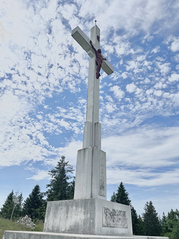
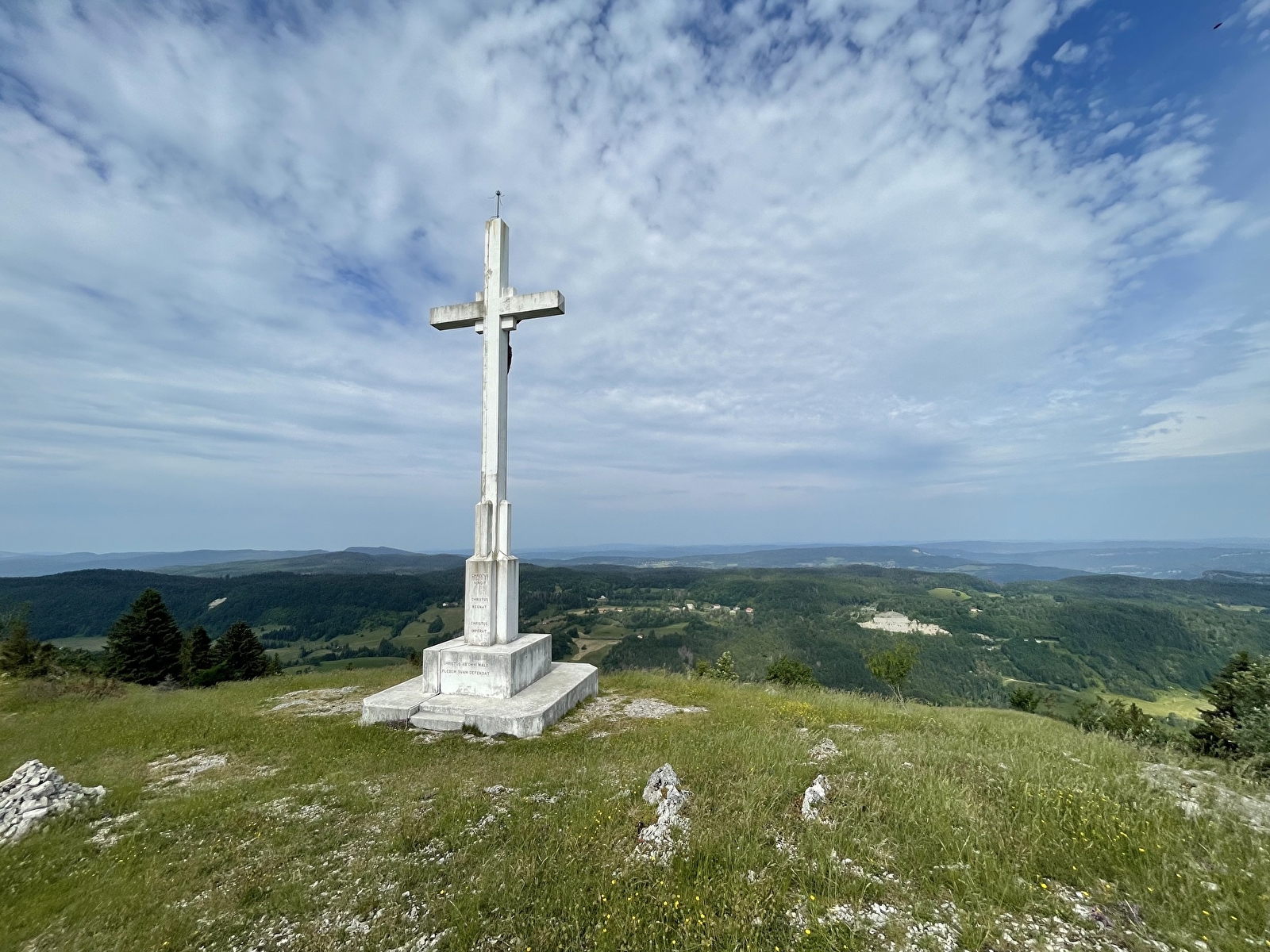
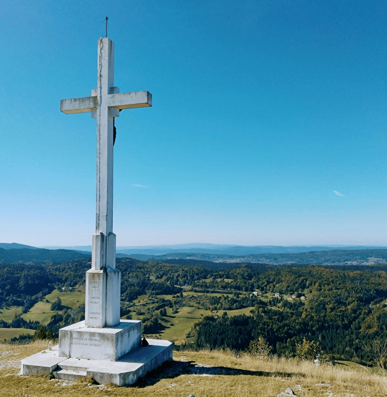
Croix des Couloirs
Discover the Corridor Cross
Return path
Saint-Claude
Time : 0h45
Distance : 1.8km
Difference in altitude: +250m
Signposted GRP
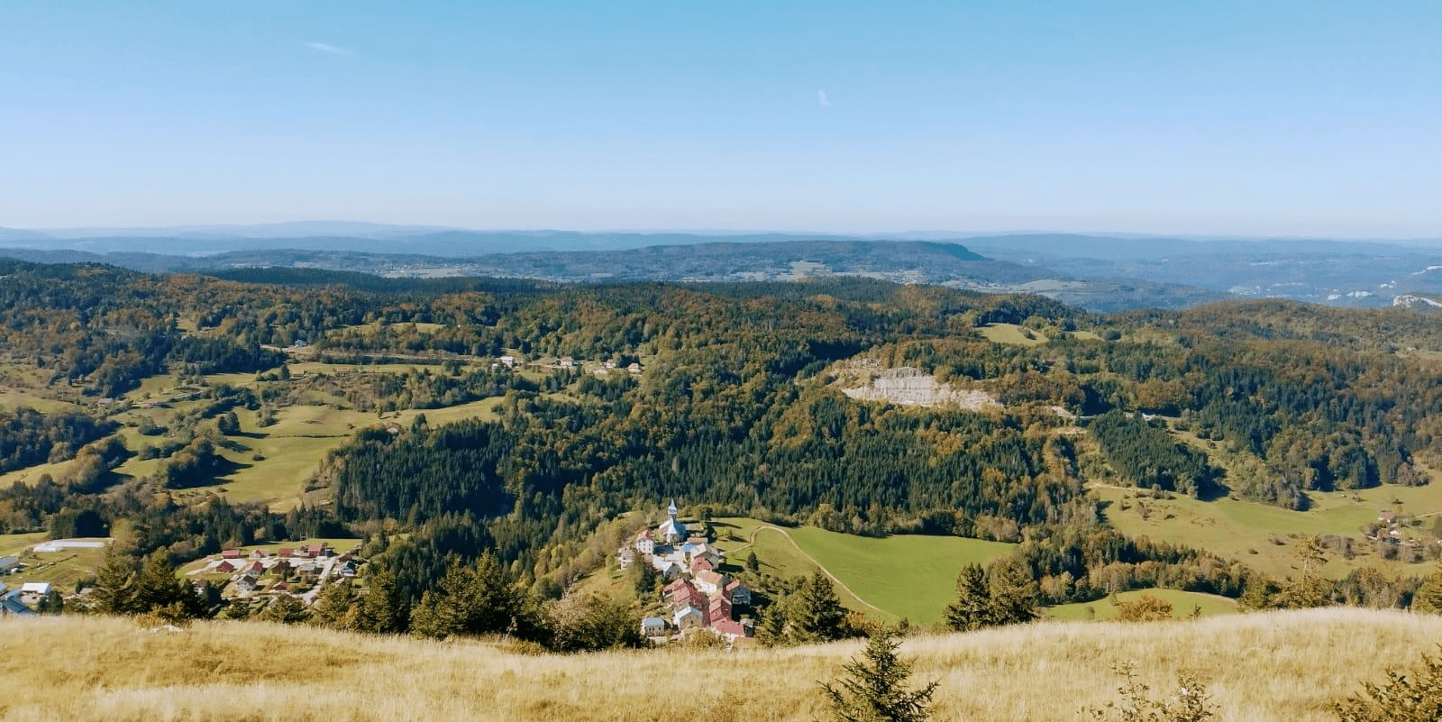
This imposing cross, which rises to an altitude of 1225 m, was erected in 1934. For some, it provides a symbolic link between the communes of La Pesse and Les Bouchoux, which were one and the same until 1832. An incredible view awaits you at the summit. To the west, Les Bouchoux and a view that extends beyond the intermediate plateaux of the Jura; to the south, the Haut-Bugey and to the east, the village of La Pesse, the Crêt de Chalam and the Monts Jura. An invitation to a journey of the senses through the upper Tacon valley, where everything is about sound, landscape and light!
Access: From Les Bouchoux, the starting point for the hikes, at the foot of the village near the bar/grocery shop, the route (signposted in yellow and red) climbs to the right along the small road running parallel to the D25E1 as far as Bonneville. The Chemin des Couloirs climbs to the right and passes a reservoir. Before a stable, climb left along a narrow path into a forest. The path leads to a rocky ridge (take care!). Follow the ridge as far as La Croix des Couloirs.
GPS coordinates :
latitude N 46.294985 / longitude E 5.819077