Le défilé de Pierre-Châtel
The Rhône, diverted in the 1980s, dug its bed in the Mont Tournier range.
The D1504 runs for more than 2 km, from Virignin to Yenne.
This area was once exploited for its mineral resources (rocks and gravel).
At the upstream entrance to the Pierre-Châtel gorge: the Saint Didier suspension bridge.
Built in the early 1880s to link Yenne in Savoie to Saint-Didier in the Ain, the bridge was destroyed on 20 June 1940 by the French army to delay the arrival of German troops before being replaced at the end of the 1940s by a new suspension bridge which opened to traffic in 1951.
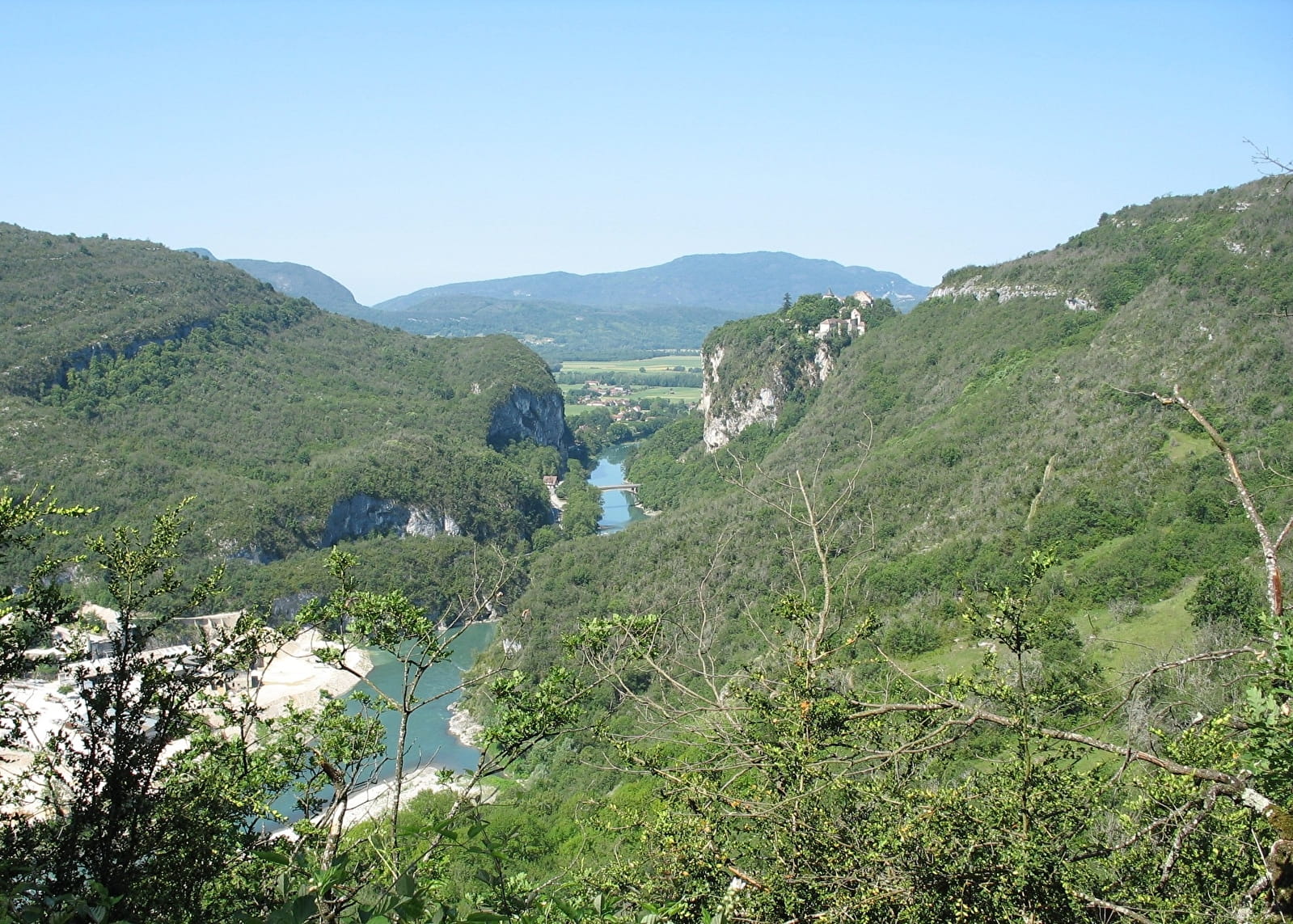
Downstream, the gorge narrows, offering a very steep landscape. This is the most natural section of the gorge.
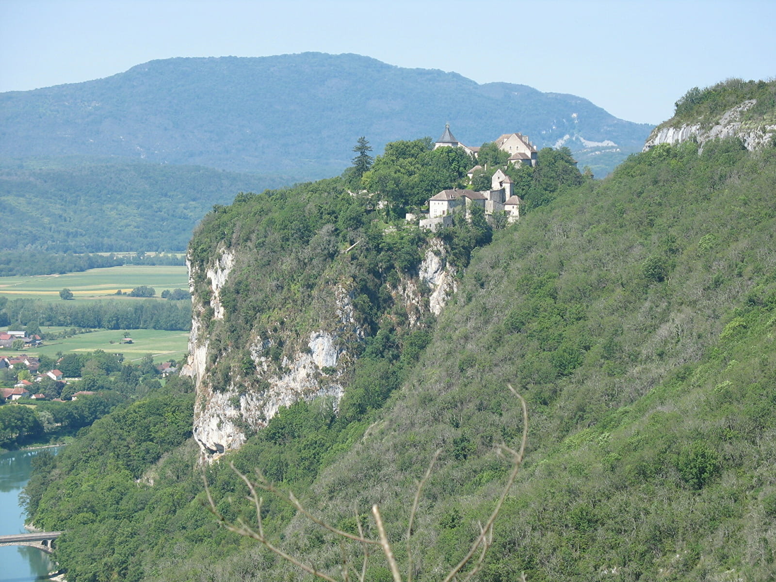
On a rocky outcrop on the right bank, closing the gorge, the silhouette of the former Charterhouse-Fortress of Pierre-Châtel, listed as a historical monument, can be seen, and above it, the former military fort of Fort-les-Bancs (private property - not open to visitors).
The road crosses the river by the Balme bridge.
At this road junction, the old cellar fort of Pierre-Châtel can be seen against the cliff (private property).
After the Pierre-Châtel gorge, the river joins the Rhône diversion canal.
This site is one of the 32 sites labelled "Sensitive Natural Areas" (ENS) in the Ain department. Within the framework of the "Schéma départemental des espaces naturels sensibles" (SDENS 2012-2017), these environments are intended to be preserved, enhanced and opened to the public, thus offering exceptional support for the promotion of the department.
- Pets not allowed