


Foot
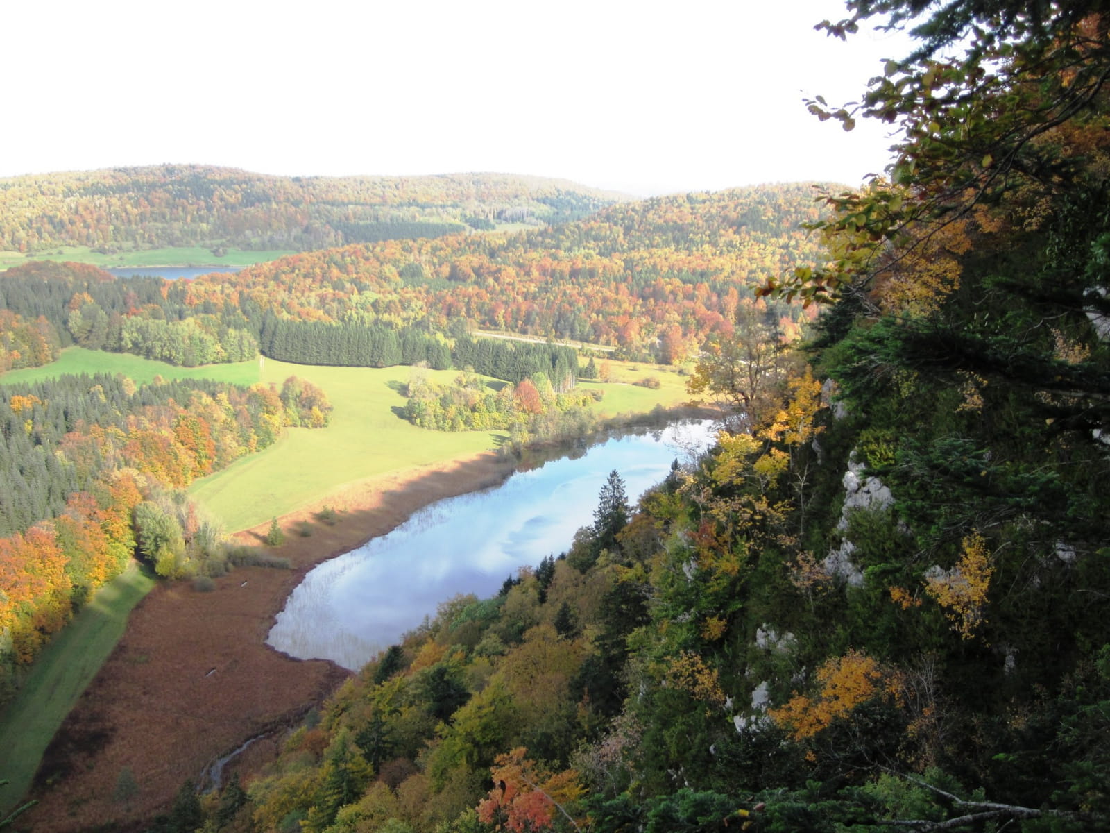
The Aigle peak and the 4 Lakes viewpoint
From the rocky bar that marks the passage from the Lakes region to the Grandvaux plateau, the Aigle peak and the Four Lakes lookout emerge during a wooded and lakeside walk.
"Place names dating back to the Druids, the path of a monastery under the waters of Lake Ilay, the circling of birds of prey on the remains of the Château de l'Aigle. You are in Charles Nodier's "Little Scotland"... Where legends are born!
Marc Forestier (Dakota Edition, What to do in the Haut-Jura Regional Nature Park)
From the PARKING DU PIC, the rocky path climbs (yellow markings) north to the Pied du Pic through beautiful dry grasslands. A steep climb (white and red markings) for 200 m leads to the PIC DE L'AIGLE.
The path continues to the north-east, winding along the wooded ridge. It approaches a forest road twice and reaches the Belvédère des Trois Lacs, Ilay, Grand Maclu and Petit Maclu.
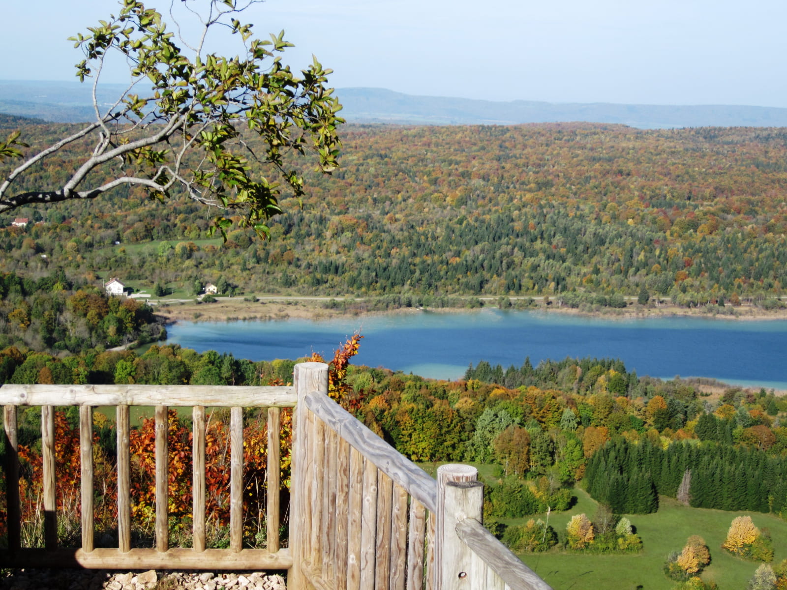
A stony path still on the edge of the ridge leads to the BELVEDERE DES QUATRE LACS (interpretation panel) in the middle of the fir trees, and the path goes up to the right to the Parking du Belvédère, below the forest road of the Bois de Ban.
The path on the left, extended by a footpath, runs along the ridge marked by sets of cliffs, without ever coming close to it. After a rapid, winding descent, slippery in wet weather, the path joins the edge of the D75 at Côte du Maclu.
By taking the cycle lane on the left at the edge of the road (yellow markings), reach the LAC DU PETIT MACLU (car park). The path then runs alongside the Petit Maclu and Grand Maclu lakes in the direction of Ilay.
From Le Chemin des Lacs, the road on the left leads to Les Rousselets and its chapel, as if set between two trees. Follow the road on the left (white and red markings) to take a path that crosses the D39 twice.
The well-marked path (former tramway) gradually climbs up to the Chemin du Château. The path is then steep up to the Pied du Pic, from where you return to the start (yellow markings).
Recommendations:
Be careful, in winter, the ascent to the Pic de l'Aigle can be slippery because it is frozen: be sure to give up! The descent to the lakes is steep and slippery at times.
This route crosses pastures with livestock, and uses forest paths. In order to respect the owners and farmers who allow you to pass through, and for the peace and quiet of the livestock and wildlife, you are invited to stay on the marked paths.
Use the passages provided to cross the fences and make sure to close the gates. Please keep your dog on a lead if you have one.
Wild flowers are beautiful, they can be rare and protected and often wither quickly. Do not pick them! They will delight the next hikers.
In the event of forestry work (felling, skidding, etc.), for your own safety, give up and turn back.
The site of the Pic de l'Aigle and the Belvedere of the 4 lakes is a classified site for its nature and the beauty of its landscapes. In order to guarantee the scenic beauty of the site, there are few rubbish bins around the 4 lakes. We count on your responsibility to take away your rubbish and participate in the preservation of the site. Thank you in advance.
For more informations The Aigle peak and the 4 Lakes viewpoint
Brochures edited by Montagnes du Jura
We tell you more
